Cane River Heritage Inventory & Map
In the spring of 2015 we created the Cane River Heritage Inventory & Map for the Cane River National Heritage Area, located in Natchitoches Parish, Louisiana. This was one of the first implementations of Arches v3, and we have since presented around the world--from Hong Kong to Liverpool--with the Getty Conservation Institute about this installation. Adam joined a team of authors to write about it in the APT Bulletin special issue on documentation (Vol. 48:4, winter 2017).

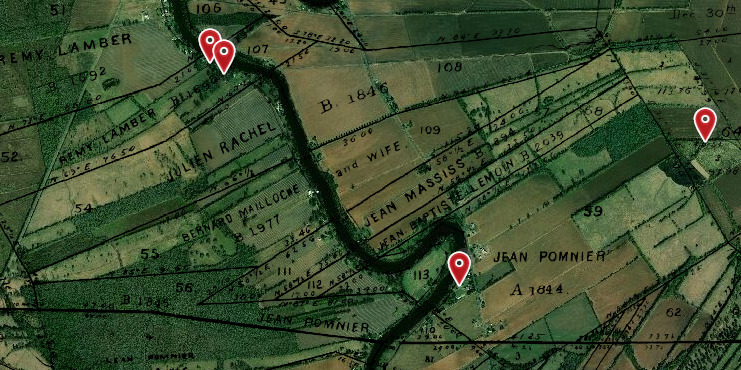
The Cane River National Heritage Area was interested in creating this database as a public-facing view that would be accessible to tourists and locals alike. We migrated their existing GIS databases (a historic building survey, as well as the full American Cemetery interment database) into the Arches installation, and incorporated some oral interviews from the 1970s as well.
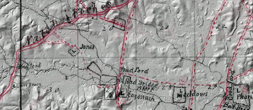
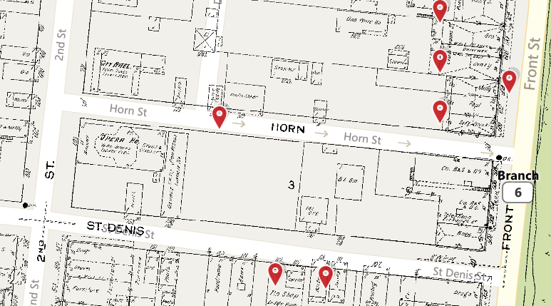
This Arches installation was particularly exciting for us because it provided a perfect opportunity to integrate historic maps with the interactive map view of the database. We edited, georeferenced, tiled, and published new web map layers from sources such as historic survey plats, USGS topos, Sanborn© fire insurance maps, and a series of previously unpublished confederate maps from the Civil War. We also used LiDAR data to make a detailed elevation basemap of Natchitoches Parish. These maps enhance the Arches map view, showing historic roads, Civil War skirmish sites, and detailed commercial information in downtown Natchitoches.
Update: Since the initial release of the Cane River Heritage Inventory & Map, the database has been decommissioned. However, we are maintaining an archived version, crhim.legiongis.com, where you can view all of the historic maps mentioned above.